 Technology Partner
Bad Elf GNSS Solutions
Precision. Everywhere. Engineered Magic® — from the sky to your screen in centimeters.
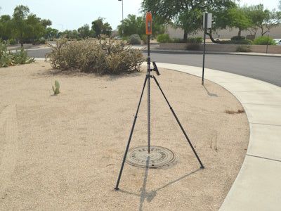
From the Sky to Your Screen in Centimeters
MFi Pioneer Since 2010
Survey-grade GNSS to any phone, tablet or laptop — iOS, Android, Windows.
Full Constellation Engine
GPS · GLONASS · BeiDou · Galileo · QZSS — all tracked simultaneously.
Field-Hardened
IP67 waterproof · −20°C to +63°C · built for real field conditions.
The Accuracy Spectrum: One Receiver, Every Job
1 cm
RTK via NTRIP
Survey-grade precision on demand.
5–10 cm
L-Band Satellite
Worldwide corrections — no base station needed.
30–60 cm
SBAS
All day, every day — ideal for GIS mapping.
$25/day
Flex Tokens
Pay only for the accuracy you need.
Bad Elf Flex®: The Survey-Grade Rover Reimagined
Starting at $2,999.99 — the most affordable full RTK rover
- Flex Standard
30–60 cm accuracy all day, every day — zero compromise on reliability.
- Flex Extreme
Multi-frequency RTK engine + Atlas L-Band — centimeter accuracy anywhere on Earth.
- World First
Daily switching between L-Band and RTK — unlimited workflow flexibility.
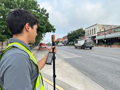
Bad Elf Flex® Mini: Mapping-Grade in Your Pocket
- Flex Mini Standard — $499.99
Sub-meter accuracy · utility poles · hydrants · stormwater drains.
- Flex Mini Extreme
Centimeter-level RTK — full precision in a palm-sized form factor.
- BYOD-First Design
Mount on phone, backpack or monopod — Bluetooth-paired, one-handed operation.
Powered by GEODNET · Launched Jan 2025
5-Year RTK for $999
One-click activation — no monthly fees, no surprises. The world's largest RTK network now exclusively powers Bad Elf corrections.
$999
5-year RTK service
40 km
Reference station guarantee across the US and Europe
Launched October 2025
Flex Mini + Pix4D: 3D Scanning from Your Smartphone
Fully Integrated
Flex Mini Extreme + PIX4Dcatch — seamless field-to-model workflow.
Built for AEC, Utilities & Public Safety
Subsurface mapping · asset documentation · infrastructure inspection.
Industry Validation
"Pocket-sized solution that doesn't compromise on accuracy or performance" — Larry Fox, VP Marketing, Bad Elf.
Engineered Magic®: Built to Work Everywhere
BYOD-First
iOS · Android · Windows — works with any location-aware app, no cellular required.
Esri Gold Partner
ArcGIS System Ready — deep integration with the world's leading GIS platform.
GSA Contract Vehicle
Streamlined procurement for government agencies — compliant and ready to deploy.
Who Uses Bad Elf GNSS?
GIS & Mapping
High-volume feature collection — poles, hydrants, drains and assets at scale.
Survey
Full RTK rover workflows at a fraction of traditional cost.
Utilities & Infrastructure
Underground mapping with PointMan software bundles.
AEC & Inspection
3D scanning, site documentation and reality capture via Pix4D.
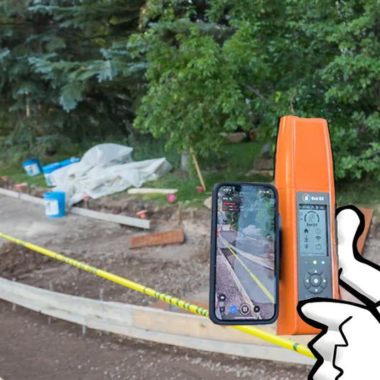
Start Collecting. Start Today.
Pioneer Package
Hardware · software · support — everything to jumpstart field data collection in one bundle.
Flex Tokens
No commitment — scale accuracy up or down at $25/day, only when you need it.
Get Started
Visit bad-elf.com or contact the team to find the right GNSS solution for your workflow.
Product information provided by Bad Elf, LLC. The webinar program itself remains educational and vendor-neutral.